Shoreline Boundary Landmarks:
Coming soon!
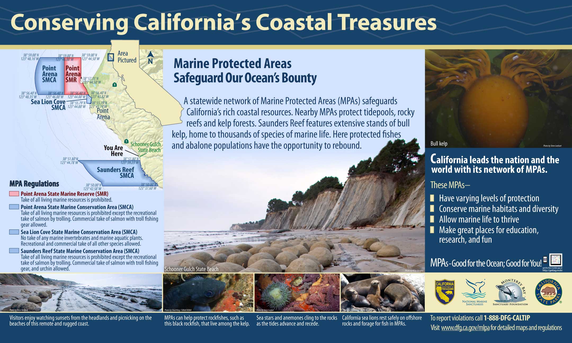
GPS Boundary:
This area is bounded by the mean high tide line and straight lines connecting the following points in the order listed except where noted:
38° 51.80′ N. lat. 123° 39.23′ W. long.;
38° 51.80′ N. lat. 123° 44.78′ W. long.;
thence southward along the three nautical mile offshore boundary to
38° 50.00′ N. lat. 123° 42.58′ W. long.; and
38° 50.00′ N. lat. 123° 37.60′ W. long.
Permitted/Prohibited Uses:
- Recreational Fishing:
- Allowed Species: Salmon by trolling.
- Prohibited Species: All other living marine resources EXCEPT those listed above.
- Commercial Fishing:
- Allowed Species: Salmon with troll fishing gear and sea urchin.
- Prohibited Species: All other living marine resources EXCEPT those listed above.
Effective as of: May 1, 2010
Additional Resources:
- Brochure: Point Arena Brochure
- Interpretive Panel: Schooner Gulch Saunders Reef MPA