GPS Boundary:
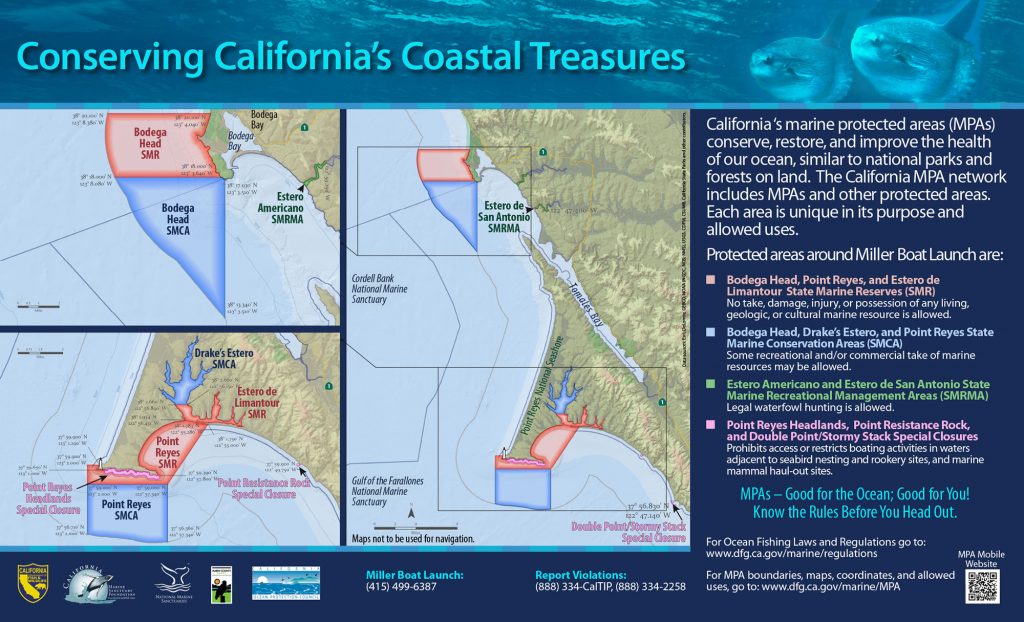
This area includes the waters below the mean high tide line within Drakes Estero northward of a line connecting the following two points:
38° 02.66′ N. lat. 122° 56.89′ W. long.; and
38° 02.66′ N. lat. 122° 56.15′ W. long.
Permitted/Prohibited Uses:
- Recreational Fishing:
- Allowed Species: Clams
- Prohibited Species: All other living marine resources EXCEPT those listed above.
- Commercial Fishing:
- Allowed Species: Aquaculture of shellfish pursuant to a valid State Water Bottom lease and permit.
- Prohibited Species: All other living marine resources EXCEPT those listed above.
Effective as of: May 1, 2010