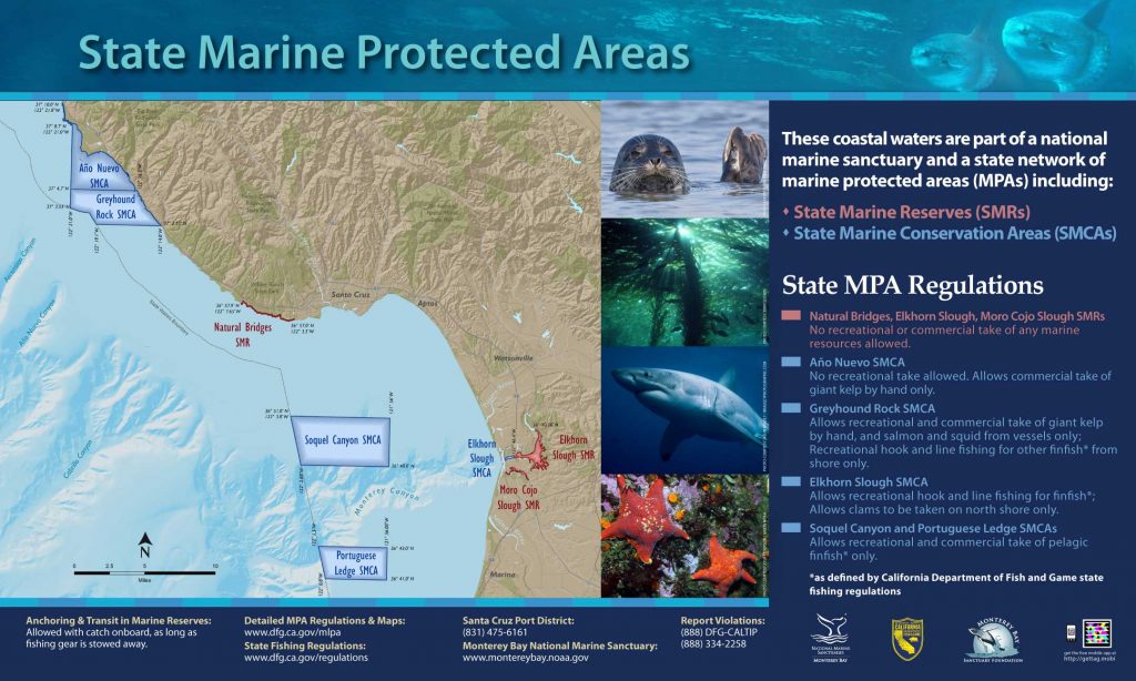
Shoreline Boundary Landmarks:
Extends from the northern edge of Four-mile beach in the north to the northern edge of the beach at Natural Bridges State Beach in the south.
GPS Boundary:
This area is bounded by the mean high tide line and a distance of 200 feet seaward of mean lower low water between the following two points:
36° 57.90′ N. lat. 122° 07.65′ W. long.; and
36° 57.00′ N. lat. 122° 03.50′ W. long.
Permitted/Prohibited Uses:
- Recreational Fishing:
- Allowed Species: None
- Prohibited Species: All
- Commercial Fishing:
- Allowed Species: None
- Prohibited Species: All
Additional Resources:
Effective as of: September 21, 2007