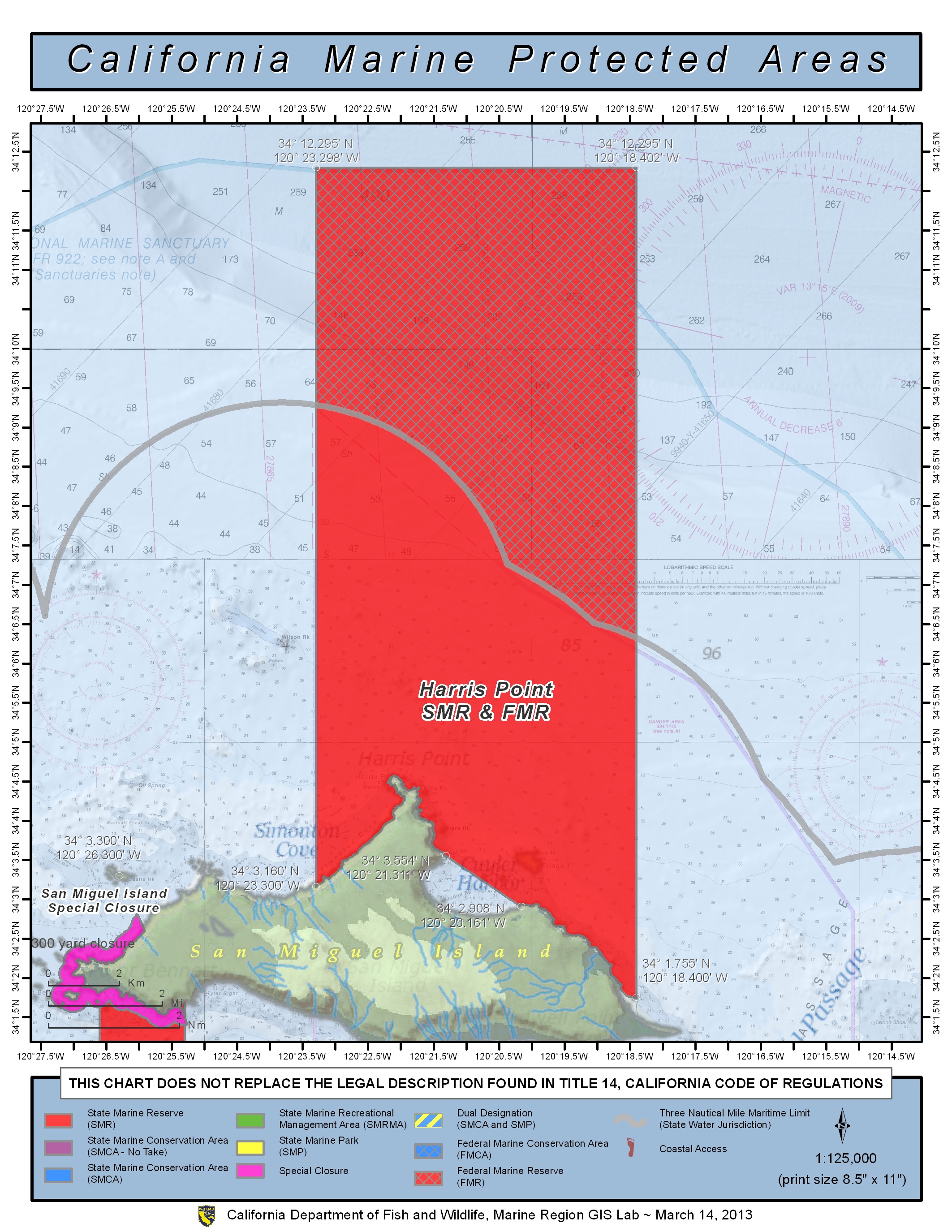
GPS Boundary:
This area is bounded by the mean high tide line and straight lines connecting the following points in the order listed except where noted:
34° 03.160’N. lat. 120° 23.300’W. long.;
34° 09.285’N. lat. 120° 23.300’W. long.;
thence southeastward along the three nautical mile offshore boundary to
34° 06.322’N. lat. 120° 18.400’W. long.; and
34° 01.755’N. lat. 120° 18.400’W. long.
An exemption to the reserve, where commercial and recreational take of living marine resources is allowed, exists between the mean high tide line in Cuyler Harbor and a straight line between the following points:
34° 03.554’N. lat. 120° 21.311’W. long.; and
34° 02.908’N. lat. 120° 20.161’W. long.
Federal MPA boundary corner coordinates
(Textual boundary descriptions and related regulations are available in the Federal Register 15 CFR Part 922 and 50 CFR Part 660).
34° 12.295′ N. lat., 120° 23.300′ W. long.
34° 12.295′ N. lat., 120° 18.400′ W. long.
34° 06.156′ N. lat., 120° 18.400′ W. long.
34° 09.120′ N. lat., 120° 23.300′ W. long.
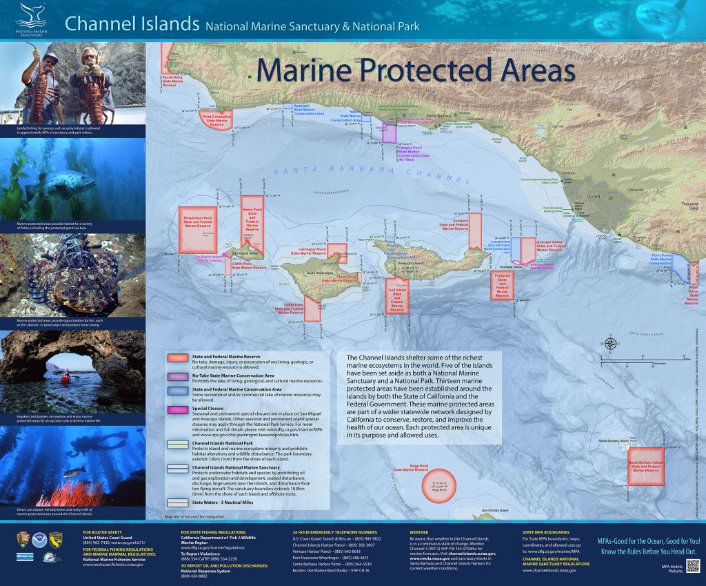
Permitted/Prohibited Uses:
- Recreational Fishing:
- Allowed Species: None
- Prohibited Species: All
- Commercial Fishing:
- Allowed Species: None
- Prohibited Species: All
Effective as of: January 1, 2012
