GPS Boundary:
This area includes the waters below the mean high tide line within Goleta Slough northward of latitude 34° 25.02′ N.
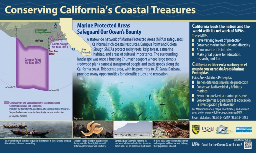
Permitted/Prohibited Uses:
- Recreational Fishing:
- Allowed Species: None
- Prohibited Species: All
- Commercial Fishing:
- Allowed Species: None
- Prohibited Species: All
- Other:
- In waters below the mean high tide line inside the Goleta Slough Ecological Reserve as defined within Section 630, the following restrictions apply:
- Boating, swimming, wading, and diving are prohibited.
- No person shall enter this area and remain therein except on established trails, paths or other designated areas except department employees or designated employees of Santa Barbara Airport, City of Santa Barbara, Goleta Sanitary District and Goleta Valley Vector Control District for the purposes of carrying out official duties.
Educational Resources:
- Santa Barbara Regional map (3.5M PDF file)
- Goleta Slough Public Access Points, Santa Barbara Channel Keeper (377k PDF file)
- Santa Barbara Channel Popular Fishing Spots, Santa Barbara ChannelKeeper (310K JPEG file)
- Explore Santa Barbara’s MPAs Brochure, Santa Barbara ChannelKeeper (347K PD file)
- Campus Point Interpretive Panel
- Santa Barbara/Ventura Harbor Brochure
Effective as of: January 1, 2012