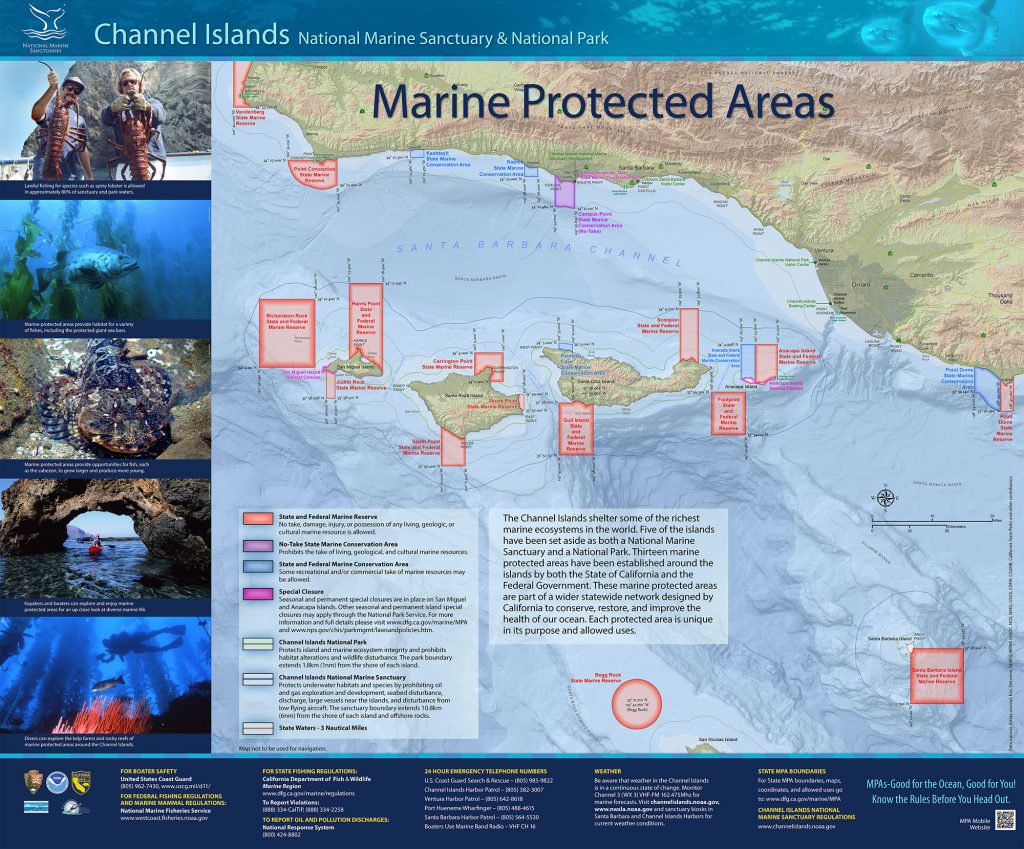
GPS Boundary:
3° 59.300’N. lat. 119° 30.965’W. long.;
33° 57.510’N. lat. 119° 30.965’W. long.;
thence eastward along the three nautical mile offshore boundary to
33° 57.264’N. lat. 119° 25.987’W. long.;
33° 59.300’N. lat. 119° 25.987’W. long.; and
33° 59.300’N. lat. 119° 30.965’W. long.
Federal MPA boundary corner coordinates
(Textual boundary descriptions and related regulations are available in the Federal Register 15 CFR Part 922 and 50 CFR Part 660).
33° 54.119′ N. lat., 119° 25.987′ W. long.
33° 54.119′ N. lat., 119° 30.965′ W. long.
33° 57.672′ N. lat., 119° 30.965′ W. long.
33° 57.426′ N. lat., 119° 25.987′ W. long.
Permitted/Prohibited Uses:
- Recreational Fishing:
- Allowed Species: None
- Prohibited Species: All
- Commercial Fishing:
- Allowed Species: None
- Prohibited Species: All
Effective as of: January 1, 2012