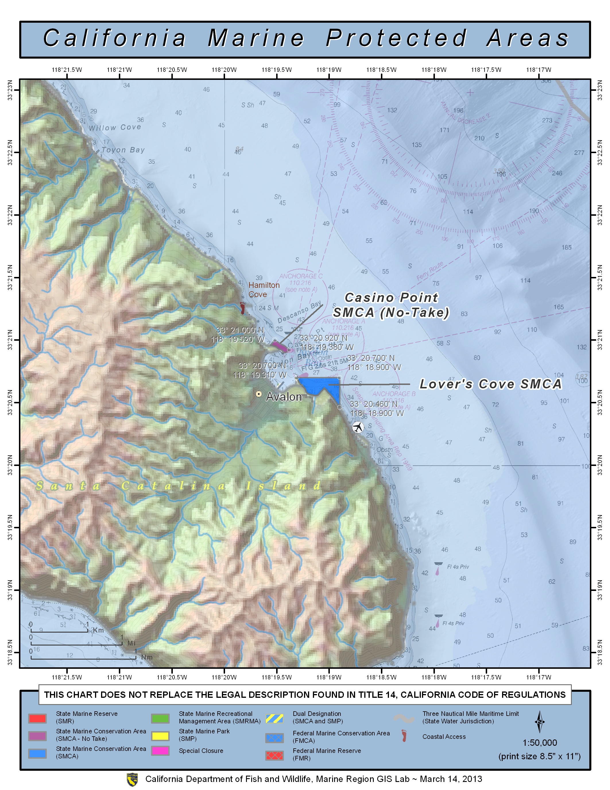
GPS Boundary:
This area is bounded by the mean high tide line and straight lines connecting the following points in the order listed:
33° 20.90′ N. lat. 118° 19.43′ W. long.;
33° 20.90′ N. lat. 118° 19.42′ W. long.;
33° 20.92′ N. lat. 118° 19.38′ W. long.;
33° 20.95′ N. lat. 118° 19.42′ W. long.;
33° 20.97′ N. lat. 118° 19.47′ W. long.;
33° 21.00′ N. lat. 118° 19.52′ W. long.; and
33° 20.96′ N. lat. 118° 19.56′ W. long.
Permitted/Prohibited Uses:
- Recreational Fishing:
- Allowed Species: None
- Prohibited Species: All
- Commercial Fishing:
- Allowed Species: None
- Prohibited Species: All
- Other Regulations:
- Feeding of fish for marine life viewing is allowed.
Effective as of: January 1, 2012
