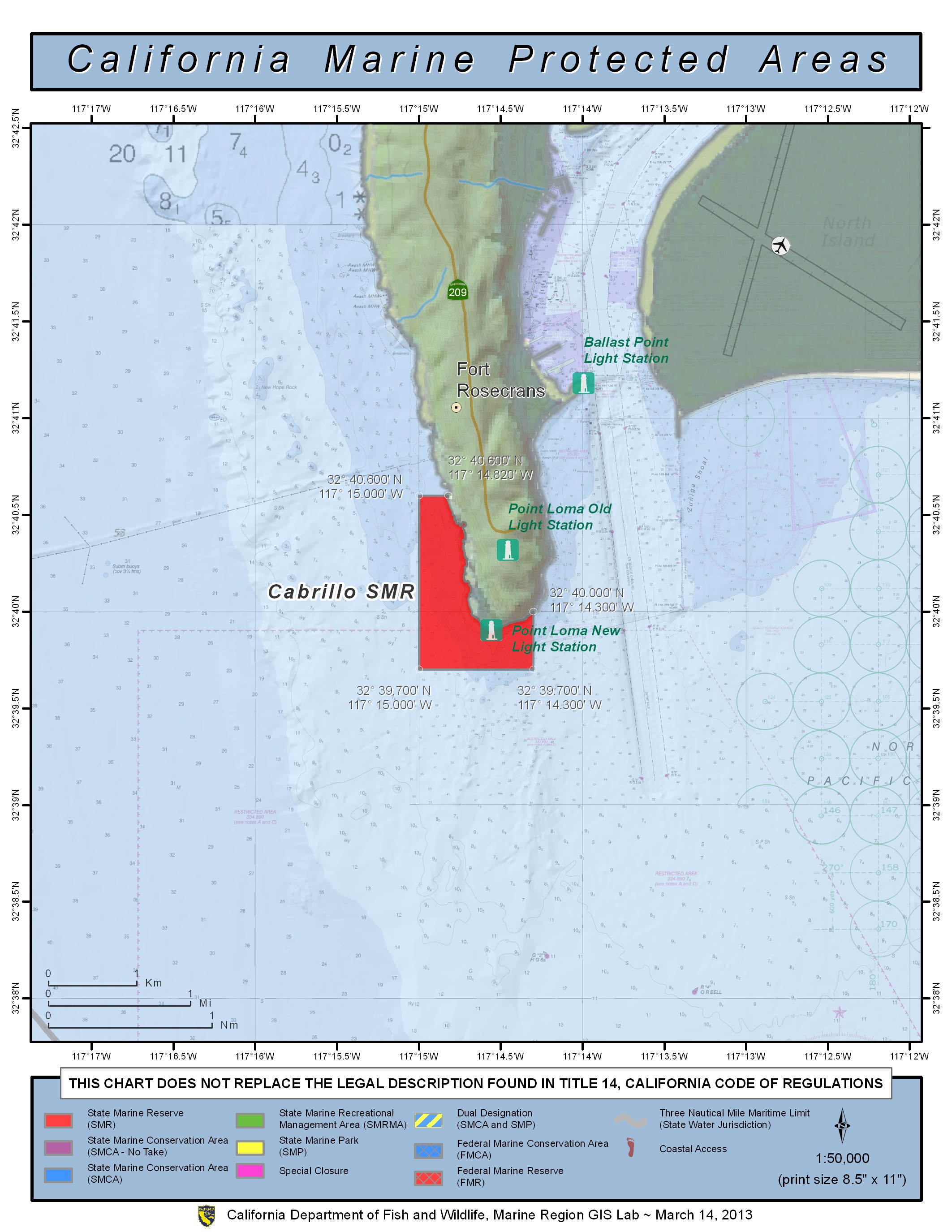
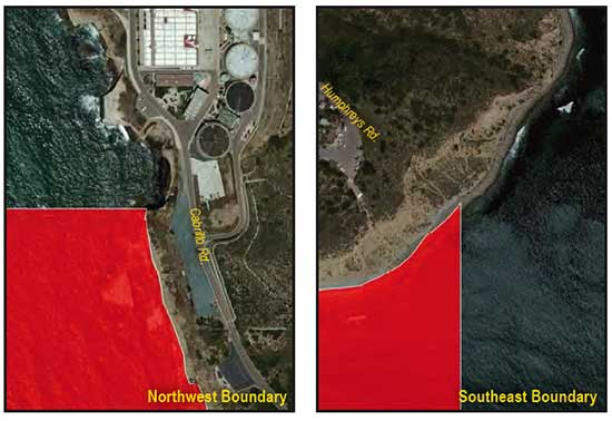
GPS Boundary:
This area is bounded by the mean high tide line and straight lines connecting the following points in the order listed:
32° 40.60′ N. lat. 117° 14.82′ W. long.;
32° 40.60′ N. lat. 117° 15.00′ W. long.;
32° 39.70′ N. lat. 117° 15.00′ W. long.;
32° 39.70′ N. lat. 117° 14.30′ W. long.; and
32° 40.00′ N. lat. 117° 14.30′ W. long.
Permitted/Prohibited Uses:
- Recreational Fishing:
- Allowed Species: None
- Prohibited Species: All
- Commercial Fishing:
- Allowed Species: None
- Prohibited Species: All
Additional Resources:
- Fishing Guide San Diego MPAs (346K PDF file)
- Marine Recreational Brochure San Diego MPAs (749K PDF file)
- San Diego Regional map (3.5M PDF file)
- San Diego Harbor Sign