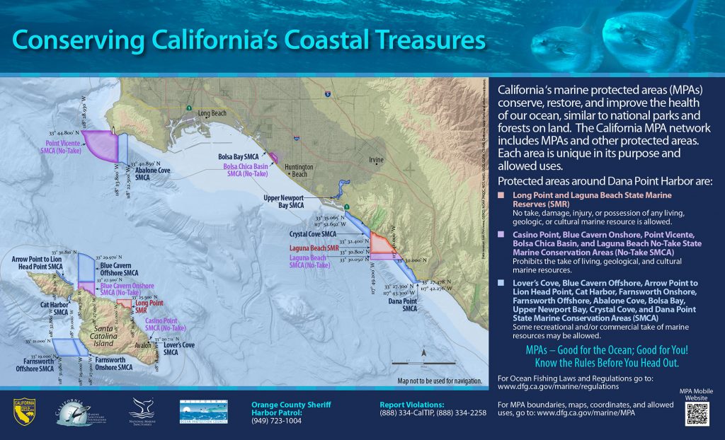
GPS Boundary:
This area includes the waters below the mean high tide line within the Bolsa Chica Basin estuary northeastward of the Pacific Coast Highway Bridge, approximated by a straight line between the following two points:
33° 41.02′ N. lat. 118° 02.15′ W. long.; and
33° 40.98′ N. lat. 118° 02.11′ W. long.;
and southeastward of a straight line between the following two points:
33° 42.22′ N. lat. 118° 03.17′ W. long.; and
33° 42.19′ N. lat. 118° 03.18′ W. lon.
Permitted/Prohibited Uses:
- Recreational Fishing:
- Allowed Species: None
- Prohibited Species: All
- Commercial Fishing:
- Allowed Species: None
- Prohibited Species: All
- Other Regulations:
-
- Boating, swimming, wading, and diving are prohibited within the conservation area.
- No person, except state and local law enforcement officers, fire suppression agencies and employees of the department in the performance of their official duties or persons possessing written permission from the department or employees of Signal Corporation and its invitees for the purpose of carrying out oil and gas operations, shall enter this conservation area and remain therein except on established trails, paths, or other designated areas.
- No person shall enter this conservation area between the hours of 8:00 p.m. and 6:00 a.m.
Educational Resources:
-
Effective as of: January 1, 2012