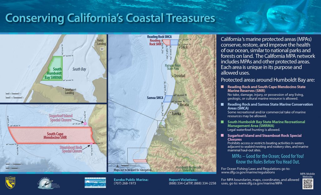
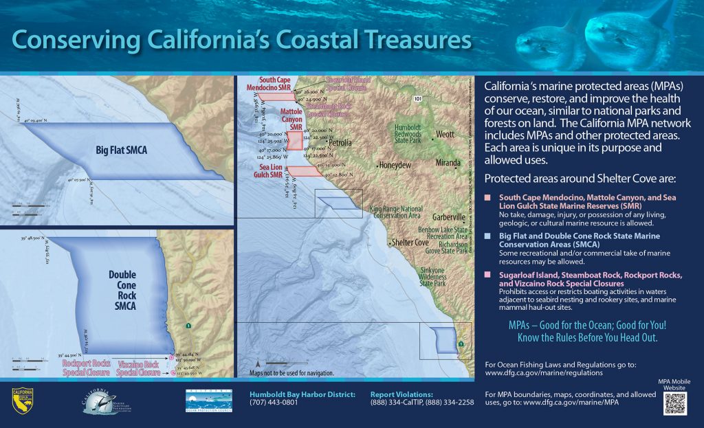
GPS Boundary:
From the mean high tide line to a distance of 300 feet seaward of the mean lower low tide line of any shoreline of Sugarloaf Island, located in the vicinity of 40° 26.326′ N. lat. 124° 24.827′ W. long.
Permitted/Prohibited Uses: *
- Recreational Fishing:
- Allowed Species: None
- Prohibited Species: All
- Commercial Fishing:
- Allowed Species: None
- Prohibited Species: All
Other Regulations:
- Except as permitted by federal law or emergency caused by hazardous weather, no vessel shall be operated or anchored at any time from the mean high tide line to a distance of 300 feet seaward of the mean lower low tide line of any shoreline of Sugarloaf Island.
- No person shall enter the area, except for agencies identified in Title 14 Section 632 CCR, when performing their official duties.
Effective as of: December 19, 2012
