GPS Boundary:
This area is bounded by the mean high tide line and straight lines connecting the following points in the order listed except where noted:
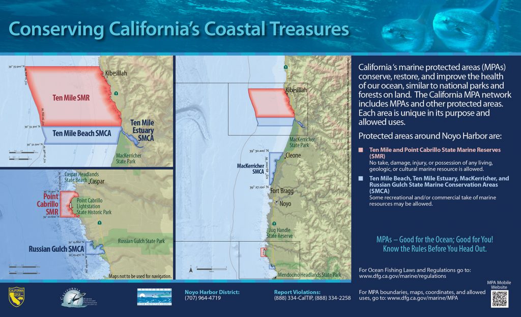
39° 30.100′ N. lat. 123° 47.390′ W. long.;
39° 30.100′ N. lat. 123° 49.000′ W. long.;
39° 27.120′ N. lat. 123° 49.000′ W. long.; and
39° 27.120′ N. lat. 123° 48.830′ W. long.
Permitted/Prohibited Uses: *
- Recreational Fishing:
- Allowed Species: None
- Prohibited Species: All
- Commercial Fishing:
- Allowed Species: All other living marine resources EXCEPT those listed below
- Prohibited Species: Bull kelp (Nereocystis luetkeana) and giant kelp (Macrocystis pyrifera)
* The following federally recognized tribe is exempt from the area and take regulations for Pyramid Point State Marine Conservation Area (subsection 632(b)(1)) and shall comply with all other existing regulations and statutes: Smith River Rancheria
Effective as of: December 19, 2012
