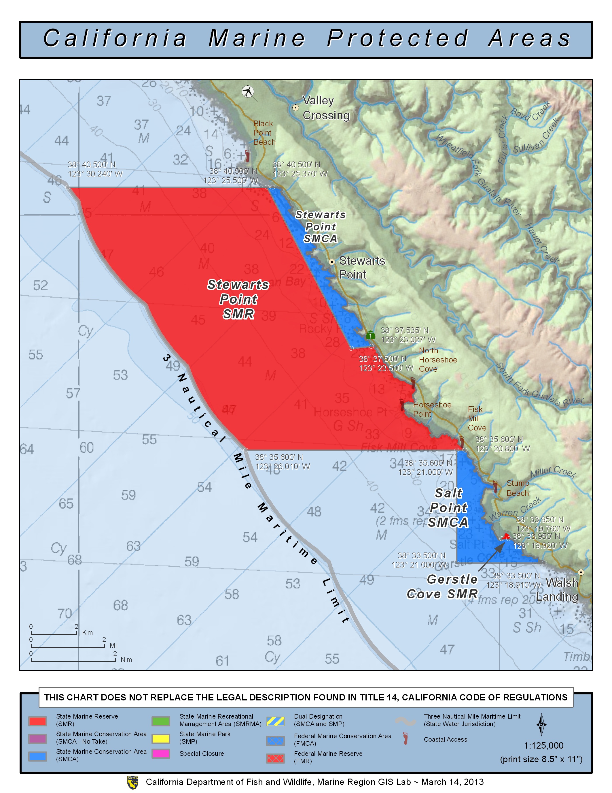
Shoreline Boundary Landmarks:
Coming soon!
GPS Boundary:
This area is bounded by the mean high tide line and straight lines connecting the following points in the order listed except where noted:
38° 40.50′ N. lat. 123° 25.37′ W. long.;
38° 40.50′ N. lat. 123° 30.24′ W. long.;
thence southward along the three nautical mile offshore boundary to
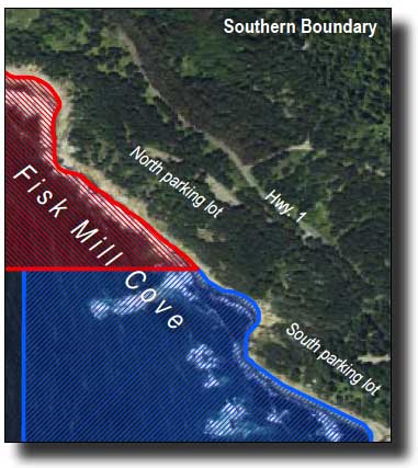
38° 35.60′ N. lat. 123° 26.01′ W. long.; and
38° 35.60′ N. lat. 123° 20.80′ W. long.
except that Stewarts Point State Marine Conservation Area as described in subsection 632(b)(11)(A) is excluded
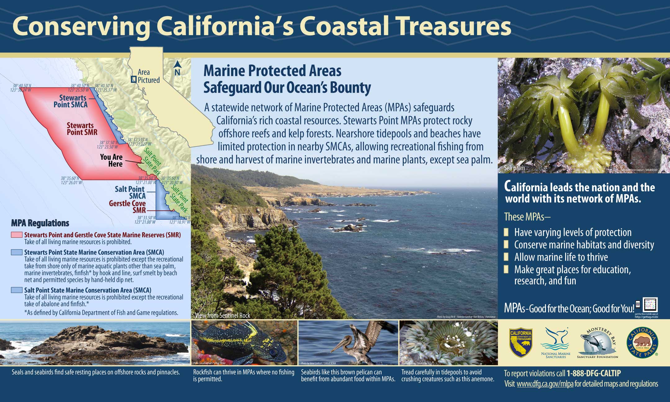
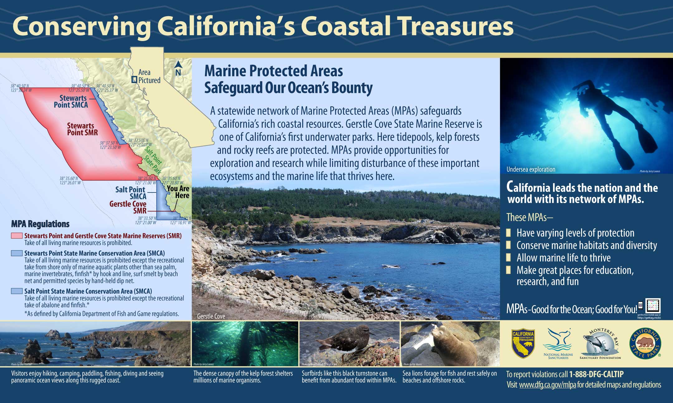
Permitted/Prohibited Uses:
- Recreational Fishing:
- Allowed Species: None
- Prohibited Species: All
- Commercial Fishing:
- Allowed Species: None
- Prohibited Species: All
Effective as of: May 1, 2010
Additional Resources:
- Brochure: Del Mar Brochure
- Interpretive Panels: