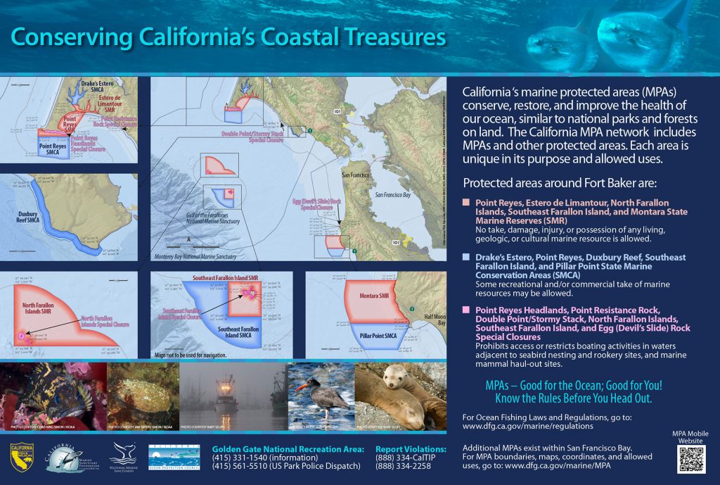
GPS Boundary:
This area is bounded by straight lines connecting the following points in the order listed:
37° 42.60′ N. lat. 122° 59.50′ W. long.;
37° 42.60′ N. lat. 123° 02.00′ W. long.;
37° 40.50′ N. lat. 123° 02.00′ W. long.;
37° 40.50′ N. lat. 122° 59.50′ W. long.; and
37° 42.60′ N. lat. 122° 59.50′ W. long.
Permitted/Prohibited Uses:
- Recreational Fishing:
- Allowed Species: None
- Prohibited Species: All
- Commercial Fishing:
- Allowed Species: None
- Prohibited Species: All
Effective as of: May 1, 2010