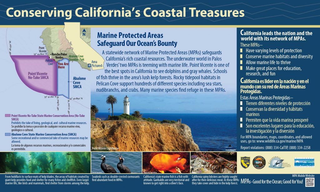
GPS Boundary:
This area is bounded by the mean high tide line and straight lines connecting the following points in the order listed except where noted:
33° 44.80′ N. lat. 118° 24.82′ W. long.;
33° 44.80′ N. lat. 118° 28.93′ W. long.;
thence southward along the three nautical mile offshore boundary to
33° 41.16′ N. lat. 118° 23.80′ W. long.; and
33° 44.19′ N. lat. 118° 23.80′ W. long.
Permitted/Prohibited Uses: *
- Recreational Fishing:
- Allowed Species: None
- Prohibited Species: All
- Commercial Fishing:
- Allowed Species: None
- Prohibited Species: All
Educational Resources:
Effective as of: January 1, 2012