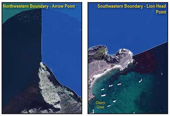
GPS Boundary:
This area is bounded by the mean high tide line to a distance of 1000 feet seaward of the mean lower low tide line of any shoreline southeastward of a line connecting the following two points:
33° 28.660′ N. lat. 118° 32.310′ W. long.; and
33° 28.820′ N. lat. 118° 32.310′ W. long.;
and northwestward of a line connecting the following two points:
33° 27.240′ N. lat. 118° 29.900′ W. long.; and
33° 27.170′ N. lat. 118° 30.100′ W. long.
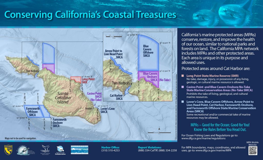
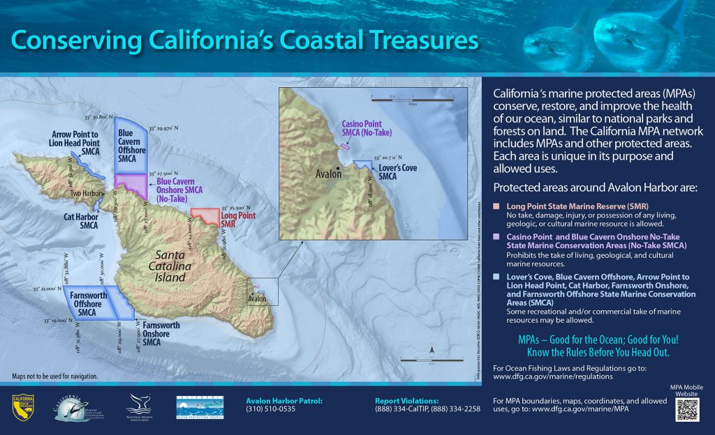
Permitted/Prohibited Uses:
- Recreational Fishing:
- Allowed Species: All living marine resources EXCEPT invertebrates.
- Prohibited Species: Invertebrates.
- Commercial Fishing:
- Allowed Species: None
- Prohibited Species: All
Effective as of: January 1, 2012
