GPS Boundary:
This area is bounded by the mean high tide line and straight lines connecting the following points in the order listed except where noted:
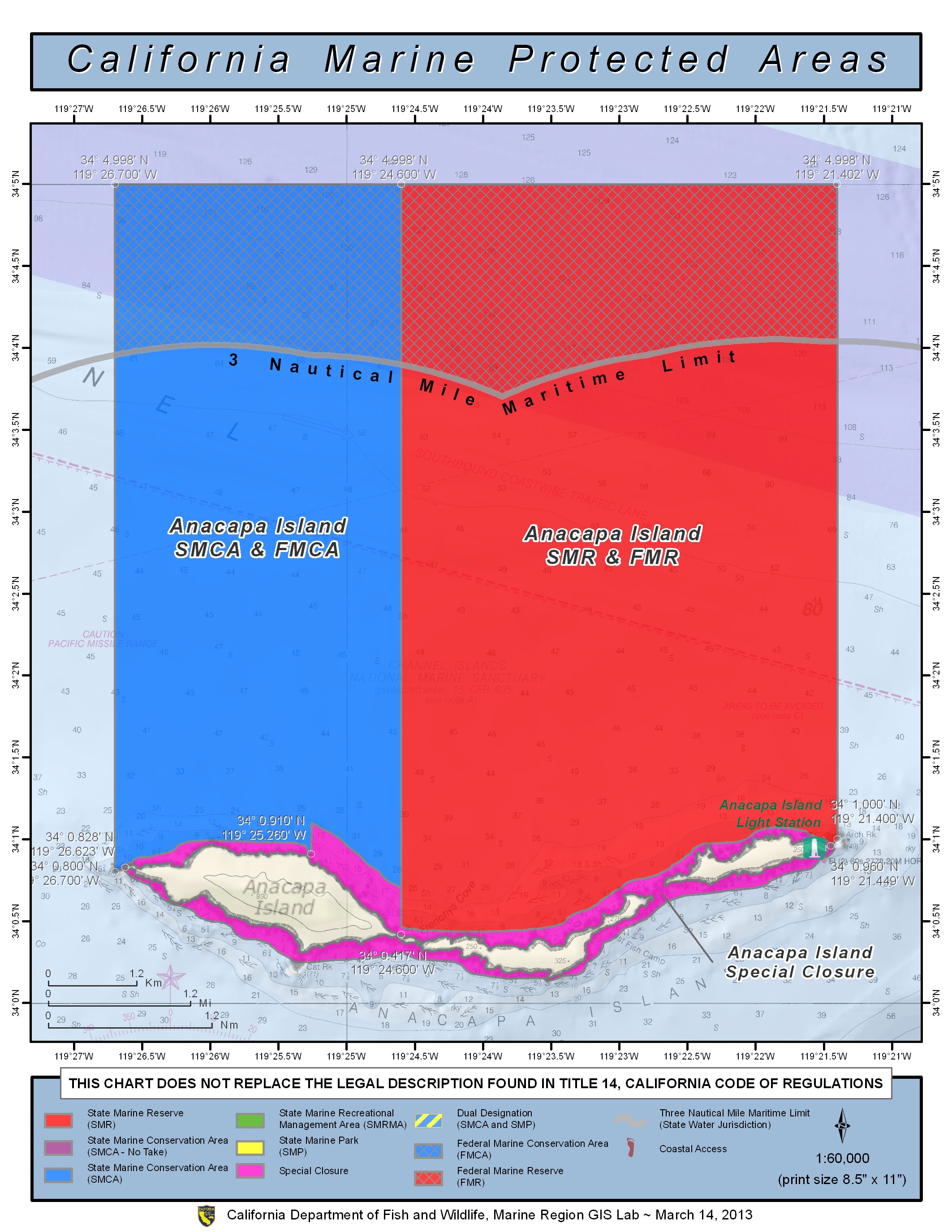
34° 00.417’N. lat. 119° 24.600’W. long.;
34° 04.002’N. lat. 119° 24.600’W. long.;
thence eastward along the three nautical mile offshore boundary to
34° 04.033’N. lat. 119° 21.400’W. long.;
34° 01.000’N. lat. 119° 21.400’W. long.; and
34° 00.960’N. lat. 119° 21.449’W. long.
Federal MPA boundary corner coordinates
(Textual boundary descriptions and related regulations are available in the Federal Register 15 CFR Part 922 and 50 CFR Part 660).
34° 04.998′ N. lat., 119° 24.600′ W. long.
34° 04.998′ N. lat., 119° 21.400′ W. long.
34° 03.870′ N. lat., 119° 21.400′ W. long.
34° 03.726′ N. lat., 119° 24.600′ W. long.
Permitted/Prohibited Uses:
- Recreational Fishing:
- Allowed Species: None
- Prohibited Species: All
- Commercial Fishing:
- Allowed Species: None
- Prohibited Species: All
Effective as of: January 1, 2012
Educational Resources:
- Santa Barbara Regional map (3.5M PDF file)
- Santa Barbara Channel Popular Fishing Spots, Santa Barbara ChannelKeeper (310K JPEG file)
- Explore Santa Barbara’s MPAs Brochure, Santa Barbara ChannelKeeper (347K PD file)
- Exploring California’s Marine Protected Areas: Anacapa Island State Marine Reserve
- Channel Islands Harbor Sign
- Santa Barbara/Ventura Harbor Brochure
- Exploring California’s Marine Protected Areas: Anacapa Island State Marine Reserve (CDFW)
